Orienteering research
The sport of orienteering is a great source of inspiration for research in artificial intelligence and more.
The challenges of navigating through complex terrains with limited information and the need for real-time decision-making align closely with many AI problems, especially for geo-spatial intelligence. I develop orienteering research through various channels: research projects, student projects, and bachelor's and master's theses.
Contact me if you are interested in working on these topics.
Activities

Conference on Orienteering in Scientific Research and Higher Education
I'm organizing the O-Conference 2026, Gothenburg, 18-19 July 2026, which aims to bring
together researchers,
educators, practitioners,
and the orienteering community to explore how orienteering inspires scientific research and higher
education.

Spatial intelligence and performance in orienteering
Research project (2026) funded by the Swedish Research Council for Sport Science
(Centrum för Idrottsforskning - CIF) titled Spatial Intelligence and Performance in
Orienteering.
The goal is to study how orienteers localize themselves on the map and make the route choices.

What is the best route choice?
The aim of this project is to develop an automated method to compute the optimal route choice in
orienteering competitions.
How do orienteers localize themselves?
This question lies at the intersection of spatial cognition, sports science, and
applied
AI.
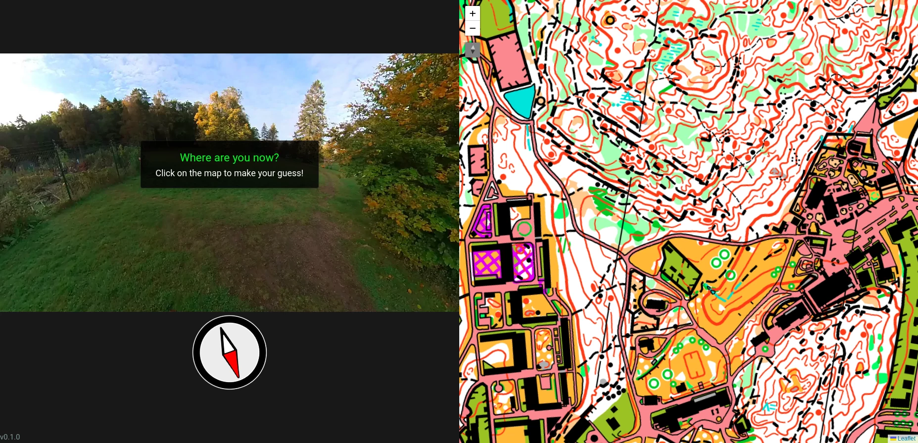
In this work, we present a novel interactive web application and accompanying dataset designed to
systematically study map-based localization in orienteering.

MSc. thesis available - Orienteering data analysis
Open position for a Master's thesis in collaboration with the national team of the Swedish
Orienteering Federation.
The goal of the thesis is to develop and evaluate methods for analyzing orienteering performance using
real-world competition and training data. The work will focus on route choice, speed, and
terrain analysis.

Can we achieve accurate localization without GPS?
Research project (2026-2027) funded by Chalmers Area of Advance Transport titled
AI methods for vision-based terrestrial localization. The goal is to develop robust, interpretable,
and infrastructure-light AI methods for localization using visual input, inertial data, and public maps such
as
OpenStreetMap and orienteering maps.

How to extract better contours from DEMs?
Master's thesis by Øyvind Hjermstad (2025) on improving contour line extraction from
Digital Elevation Models.